언어: 영어
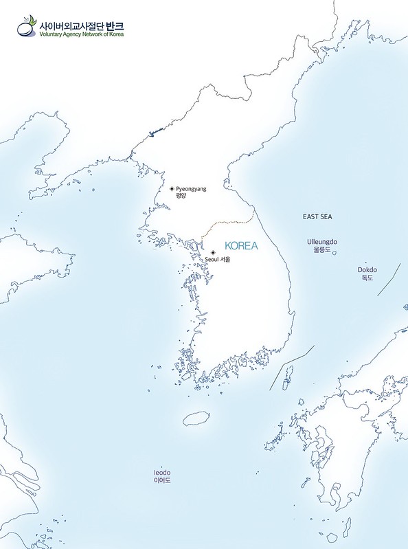
사이버외교사절단 반크는 우리나라의 해양영토를 알리기 포스터를 제작했습니다.
해양영토는 우리나라의 주권 및 주권적 권리가 미치는 영해와 배타적경제수역(EEZ), 대륙붕 등을 포함해 부르는 용어입니다. 구글에서 일본 지도를 검색하면 지도에 해양영토를 거의 소개하는 반면 한국 지도에는 해양영토가 제대로 안 보입니다.
이에 따라 우리나라 주권이 미치는 해양 영역이 그려진 한국 지도를 전세계에 제대로 알려나갈 필요가 있습니다.
무엇보다 한국의 이웃나라인 일본과 중국은 해양영토에 대한 높은 관심을 가지고 있으며, 동북아는 방공식별구역으로 갈등과 긴장이 높아지고 있는 상황입니다.
우리가 무관심하고 있는 사이에 일본과 중국은 적극적으로 해양영토를 전세계에 알리고 있고, 이런 이유로 국제사회에 독도등이 제대로 알려지지 않고 있습니다.
따라서 한국또한 배타적 경제수역과 대륙붕한계를 포함하여 해양 영토주권이 미치는 모든 바다와 육지를 담아낸 지도가 적극적으로 홍보해야 합니다.
이에 따라 반크는 울릉도와 독도, 이어도등 한국의 해양영토가 반영된 디지털 영문 한국지도 4장을 제작해 전세계에 알려나갑니다.
Map of Korea’s maritime territory.
VANK made a poster to promote Korean maritime territories.
Maritime territory is a term that includes the territorial sea, the EEZ, and the continental shelf, which the sovereignty and sovereign rights that Korea has. When you search a Japanese map on Google, the map introduces almost all of the maritime territories, whereas the Korean map does not properly show the maritime territories.
Therefore, it is necessary to properly inform the world of Korea’s map, which depicts the maritime regions of our sovereignty.
Above all, Korea’s neighboring countries, Japan and China, have a high interest in maritime territories, and the Northeast Asia is in a situation where conflicts and tensions are increasing with the Air Defense Identification Zones.
While Koreans are not interested in this, Japan and China are actively promoting maritime territories to the world, and for this reason, Dokdo and other Korean territories are not properly known to the international community.
Therefore, Korea should also actively promote maps that contain all the seas and lands of maritime territorial sovereignty, including EEZ and continental shelf limits.
Accordingly, VANK created four digital English Korean maps that reflect the Korean maritime territories such as Ulleungdo, Dokdo and Ieodo, to notify the world about Korean maritime territories..


